KENORA — Some evacuations have been ordered west of Kenora due to a forest fire that broke out in the Ingolf area Monday, jumped a lake and burned a path 22 kilometres long.
The Ministry of Natural Resources said a precautionary evacuation of the community was underway Monday evening under the coordination of Ontario Provincial Police.
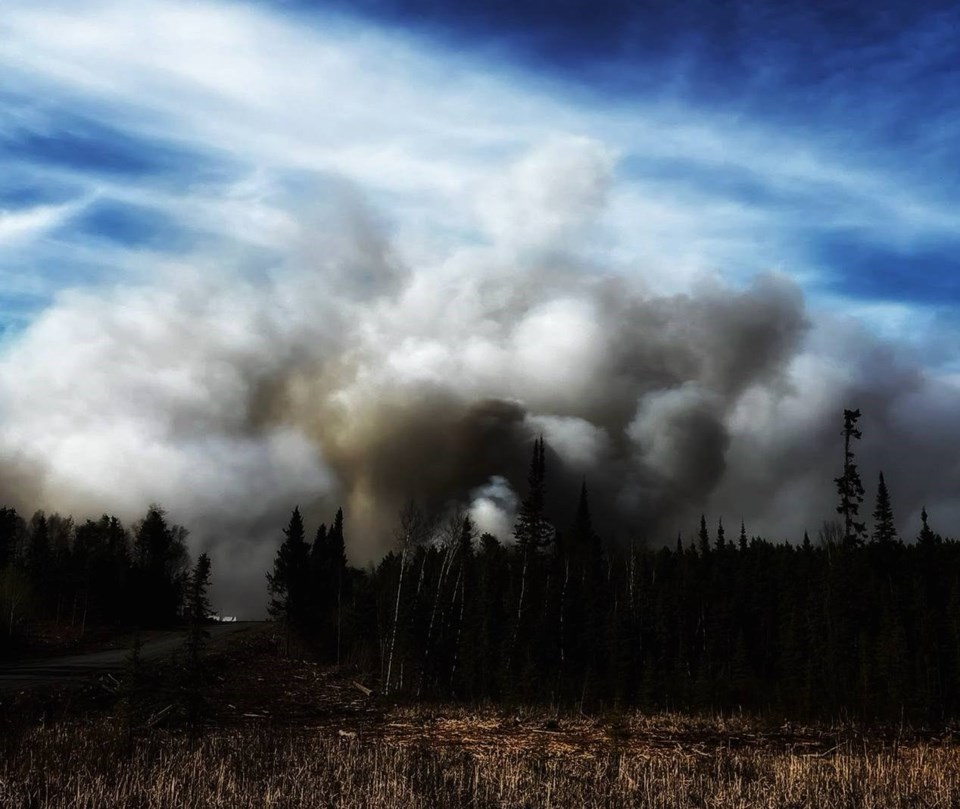
By Tuesday morning, with the fire having spread to 8,000 hectares, a spokesperson said the evacuation also involved people in surrounding areas.
Pellatt United Firefighters, a group of volunteer firefighters, posted on social media that the evacuation was expanded to include Rice Lake, Malachi and Ottermere, with Pelican Pouch on standby.
"The Ingolf fire has jumped the CN Rail line at Rice Lake and is heading north to the Scott Lakes area...and is expected to run hard today with the heat and winds for the next couple of days," it said.
MNR spokesperson Chris Marchand said Tuesday evening that the fire was only nine kilometres southwest of Wabaseemoong Independent First Nations, and that preparations were underway for an evacuation there.
The MNR continues suppression efforts with waterbombers, focusing primarily on the protection of structures.
An Incident Management Team has now been assigned to this fire.
Marchand told Newswatch rain is in the forecast for Thursday and Friday, and that may bring some relief to firefighters.
A number of other fires continued to burn across the region Tuesday.
East of Atikokan, CL-415 waterbombers and four fire ranger crews remained at the scene of a 180-hectare fire near the north side of Crystal Lake,
That fire forced the temporary closure of Highway 11 on Monday.
No structures have been damaged by the blaze.
In the Thunder Bay district, a 148-hectare fire was burning west of Highway 811 and just southeast of Garden Lake.
Among other fires of note, an outbreak that initially caused concern about the safety of residents in Wabaseemoong Independent First Nations remained at about 1,300 hectares in size, the same as on Monday.
The MNR reported the wildland fire hazard is extreme across most of the Northwest Region, especially through the Fort Frances, Dryden and Kenora fire management sectors, but also in parts of the Red Lake, Sioux Lookout and Thunder Bay sectors.
Forest fires burning in northwestern Ontario and southeastern Manitoba are also impacting air quality and visibility.
Environment Canada issued air quality statements Tuesday morning concerning conditions in numerous communities, particularly those closer to the Ontario-Manitoba border, but as far east as Shebandowan and as far north as Pigangikum.
"Smoke may continue to affect the area through Wednesday," it said. "As smoke levels increase, health risks increase."
The statement advised residents in the affected areas to limit their time outdoors.
Those most vulnerable to smoke particles include individuals 65 and older, pregnant people, young children, and those with an existing illness or chronic health condition.
Heat warnings also remain in effect for much of the region.
Environment Canada cautioned that temperatures of 30 C or more increase the risk that health issues will be exacerbated.
