ATIKOKAN — The bold decision to drain a lake and divert a river to access iron ore for the war effort in the 1940s led to impressive engineering feats that are now the focus of a set of historical markers in Atikokan.
The local museum arranged for the recent installation of new signage that provides a sense of the massive scope of the effort it took to develop the Steep Rock and Caland Ore mines, which continued to operate until about 1979.
The ore deposits were first discovered in 1938, but could not be accessed without an immense water diversion project including altering the course of the Seine River and draining Steep Rock Lake.
This required the construction of multiple dams, tunnels and other works, and the dredging of over 200 million tons of sediment from the lake bottom.
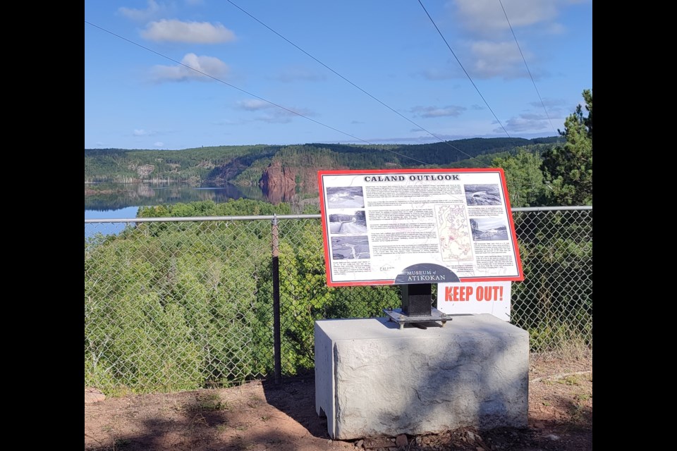
The historical markers with information and photos that illustrate some of these undertakings can be viewed at the Caland Outlook and the Seine River Diversion.
As one of the markers indicates, rerouting the river system to develop the ore deposits was considered such a huge challenge that it "drew a fair amount of skepticism."
Other markers focus on the Finlayson Tunnel, the Raft Lake Cut, and the development of the Caland mine in the eastern arm of Steep Rock Lake.
The project was initiated by Lois Fenton, the former curator of the Museum of Atikokan, who reworked the exhibits about the story of iron mining in the community.
"It's a very significant piece of Canadian history...I just thought the story should not be lost," she told Newswatch.
Fenton said it took her about four years to read and re-read all the available documents.
"I come from a historic background. I am not a mining expert. All the information was difficult to read and understand. But to put it into history that the public would be interested in and be able to understand was my job."
Fenton said that while she was assembling all the material at the museum, she was also visiting the mine site to get a proper understanding of how large the mining development was.
"If I said to you, for instance, that seven square miles was taken up by mines, I don't have a mental picture of what that looks like. But when you're standing at the table on the lookout, and you can see ahead of you part of the mine in the mining landscape, then you have an idea of the enormity of the project."
She pointed to the multiple barriers the work crews faced in a hostile environment.
"This was happening at the beginning of the war, and all the materials and the mechanics were being pulled off for the war. In the early years out there, they were working with old machinery, severe weather, very challenging circumstances."
One way to understand what they accomplished, Fenton said, is to visit the exhibit at the museum, "but many people really find it more poignant to go to the site and actually see what this project was all about."
The current curator, Patty Nagle, said the early feedback about the historical markers has been encouraging.
"We're getting a lot of positive reviews that this needs to be done, that it is so great to to highlight our history. If I wasn't involved with the museum, I'd look at as just a body of water. But now, with these panels, you can see it was actually a mine, and you get information about how it was developed and what was going on there years ago."
Nagle credited the support of several local businesses, which voluntarily helped the museum complete the $20,000 project.
