KENORA – One new fire was confirmed in the Northwest Region by the late afternoon of June 23.
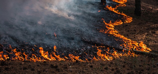
The fire was discovered south of Robinson Lake, approximately 40 kilometres southeast of Kenora.
Two waterbombers and a bird dog aircraft were dispatched to fight the blaze, which at the time of reporting is one hectare, however, as of 8 a.m. this morning the blaze has grown to five hectares.
At the time of this update, the fire is under control and being held by fire emergency services.
The Robinson Lake fire is the only active fire at this time.
At the time of this update the wildland fire hazard was mostly high throughout the Kenora, Dryden, Fort Frances and Thunder Bay and southern Nipigon sectors. Hazard conditions in Red Lake, Sioux Lookout and northern Nipigon sectors were primarily moderate to low.
The AFFEF reminds the public that “as we transition to summer that despite ample rainfall in the Northwest, it doesn’t fall evenly across the landscape and that fire hazard conditions can vary significantly between different locations and types of forest fuels.”
With the Canada Day long weekend ahead, AFFEF wants people to be cautious with campfires and fireworks, ensuring they are completely extinguished.
Fires are to be ignited no sooner than two hours before sunset and extinguished no later than two hours after sunrise. Always have tools/water adequate to contain the fire at the site. Know the rules for safe outdoor burning. Consult the full set of Outdoor Burning Regulations. If you intend to burn within the boundaries of a municipality, check with your local fire department for restrictions or permitting requirements.
To report a wildland fire located north of the French and Mattawa rivers, please dial 310-FIRE. To report a forest fire located south of the French or Mattawa rivers, please dial 911.
For tips on preventing wildland fires and information on the current fire situation, follow us on Twitter in English and French @ONforestfires and @ONfeudeforet.
You can check the wildland fire hazard in your local area using our interactive map at www.ontario.ca/forestfire.
