WABASEEMOONG — Wildfire officials have confirmed Wabaseemoong Independent Nations has been evacuated as a large forest fire is very close to the community.
“The community underwent an evacuation yesterday with just a few key personnel and firefighting staff remaining in the town site,” said Chris Marchand, a fire information officer with the Ministry of Natural Resources, who is specifically assigned to two fires in the Kenora area.
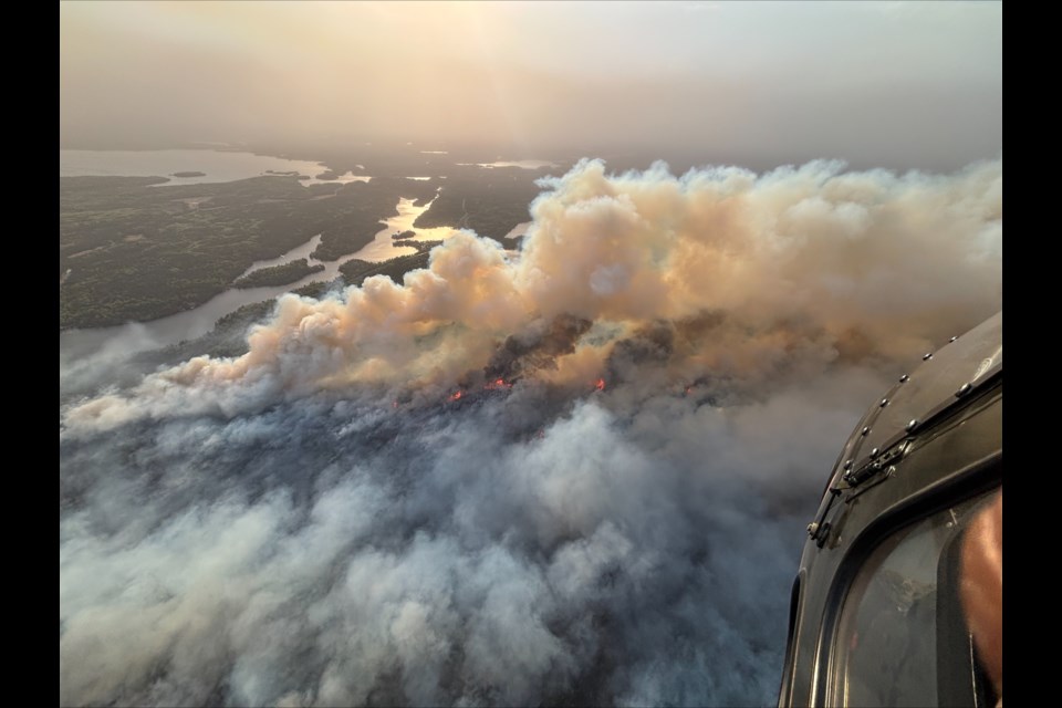
Marchand said the 23,000-hectare blaze that forced the evacuation — known as Kenora Fire 20 — was within 2.5 kilometres of Wabaseemoong Wednesday afternoon. Another fire — Kenora Fire 14 — was just over 1,500 hectares in size and remained about 12 kilometres north of the First Nation.
Neither fire was under control.
An official with Thunder Bay Fire Rescue told Newswatch that a request was made for evacuees to come to Thunder Bay, but that the city doesn’t have capacity because of the ongoing evacuation of Neskantaga First Nation community members due to the closure of their nursing station.
Instead, the fire department said, evacuees from Wabaseemoong and other areas affected by the Kenora fires were sent to Winnipeg.
Near the First Nation itself, Marchand said water bombers are being used on parts of the fire closest to the community, while ground crews are setting up sprinklers around “critical infrastructure and other priority structures within the community.”
He said weather conditions across the region, especially in the far west, are ripe for wildfires.
“We've really seen a prolonged period of dry weather over the past two weeks,” Marchand said. This, combined with high temperatures and really high wind speeds over the last week and low relative humidity, it’s creating that extreme fire hazard through most of the region.”
“We're really witnessing how these weather-driven conditions are driving fire behaviour at this point in the spring, when the forest is only kind of beginning to green up.”
Marchand also confirmed that the fires have consumed some structures, but said he had no specifics about where, how many or what type of buildings they were.
At the south end of the fire, near the Manitoba border, firefighting efforts are focusing on using sprinklers to try and defend buildings, the use of water bombing aircraft and helicopters bucketing water, said Marchand, as well as a “limited amount of firefighting in the Ingolf area near the origin of the fire.”
Hose lines have also been deployed around Longpine Lake, he added.
As of Wednesday, an MNR evacuation order was affecting a large portion of the region. In a Facebook post on Wednesday, the ministry said a concurrent “implementation order” also prohibits entry, unnecessary travel and use of roads and use or occupation of Crown lands. Entry is only allowed with a travel permit from the MNR, the post said.
All use of lakes and waterways is prohibited.
The affected areas include:
- Gundy Road north of Tannis Lake
- Pickerel Lake Road beyond the Pelican Pouch access point at kilometre marker 9
- Cygnet Lake Road
- Winnipeg River below Whitedog Falls
- Eaglenest Lake
- Tetu Lake
- Cygnet Lake
- Rice Lake
- Malachi Lake
- Otter Lake
- Macara Lake
- Longpine Lake
- Dagimabrop Lake
