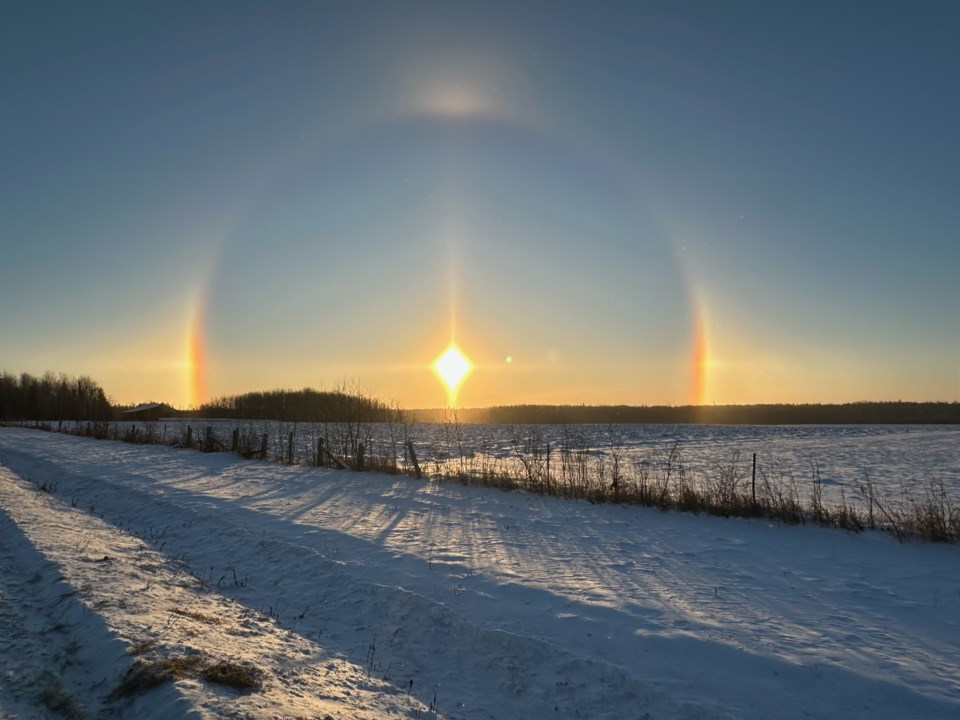
Today's image is from Jaymie Penny-Copenace.
Got a Story idea? Send it here. Got a Good Morning Photo to Share? Send it here.
Fort Frances
| Periods of light snow ending in the morning then mainly cloudy with 40 percent chance of flurries. Wind up to 15 km/h. High minus 18. Wind chill minus 37 in the morning and minus 22 in the afternoon. Risk of frostbite. UV index 1 or low. |
Atikokan
| Periods of light snow ending in the afternoon then mainly cloudy with 40 percent chance of flurries. Wind up to 15 km/h. High minus 18. Wind chill minus 32 in the morning and minus 25 in the afternoon. Risk of frostbite. |
Ignace
| Periods of light snow ending in the morning then mainly cloudy with 40 percent chance of flurries. Wind becoming west 20 km/h early in the afternoon. High minus 19. Wind chill near minus 33. Risk of frostbite. UV index 1 or low. |
Dryden
| Periods of light snow ending in the morning then mainly cloudy with 40 percent chance of flurries. Wind becoming west 20 km/h early in the afternoon. High minus 19. Wind chill near minus 33. Risk of frostbite. UV index 1 or low. |
Kenora
| Periods of light snow ending in the morning then mainly cloudy with 40 percent chance of flurries. Wind up to 15 km/h. High minus 18. Wind chill minus 33 in the morning and minus 22 in the afternoon. Risk of frostbite. |
Red Lake
| Periods of light snow ending in the morning then mainly cloudy with 40 percent chance of flurries. Wind up to 15 km/h. High minus 19. Wind chill near minus 32. Risk of frostbite. UV index 1 or low. |
Sioux Lookout
| Periods of light snow ending in the morning then a mix of sun and cloud with 40 percent chance of flurries. Wind up to 15 km/h. High minus 19. Wind chill minus 33 in the morning and minus 26 in the afternoon. Risk of frostbite. UV index 1 or low. |
