Here's a look at the current local weather and gas prices.
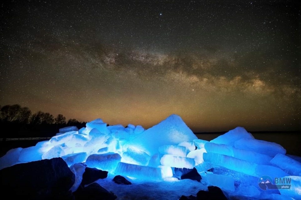
Today's image is from Blair Wright.
Got a Story idea? Send it here. Got a Good Morning Photo to Share? Send it here.
Fort Frances
| Mainly cloudy. 30 percent chance of flurries in the morning with risk of freezing drizzle. Wind becoming west 30 km/h gusting to 50 in the morning. High 7. Wind chill minus 7 in the morning. UV index 3 or moderate. |
|
|
|
Atikokan
| Cloudy. Wind becoming southwest 30 km/h gusting to 50 late in the morning. High plus 5. Wind chill minus 10 in the morning. UV index 2 or low. |
|
|
Ignace
| Cloudy. 30 percent chance of flurries in the morning. Rain mixed with snow beginning late in the afternoon. Risk of freezing drizzle in the morning. Wind becoming southwest 30 km/h gusting to 50 in the morning. High plus 2. Wind chill minus 10 in the morning. UV index 2 or low. |
|
Dryden
| Cloudy. 30 percent chance of flurries early in the morning. Rain or snow beginning late in the afternoon. Risk of freezing drizzle early in the morning. Wind becoming southwest 30 km/h gusting to 50 in the morning. High plus 2. Wind chill minus 9 in the morning. UV index 2 or low. |
|
|
Kenora
| Mainly cloudy. 30 percent chance of flurries early in the morning. Rain or snow beginning late in the afternoon. Risk of freezing drizzle early in the morning. Wind becoming southwest 30 km/h gusting to 50 in the morning. High plus 2. Wind chill minus 12 in the morning. UV index 2 or low. |
Red Lake
| Mainly cloudy. Snow beginning in the afternoon. Amount 2 cm. Wind becoming southwest 30 km/h gusting to 50 in the morning. High plus 2. Wind chill minus 17 in the morning. UV index 2 or low. |
|
|
|
|
Sioux Lookout
| Mainly cloudy. Snow beginning in the afternoon. Amount 2 cm. Wind becoming southwest 30 km/h gusting to 50 in the morning. High plus 2. Wind chill minus 9 in the morning. UV index 2 or low. |
|